
")
Hungary
-

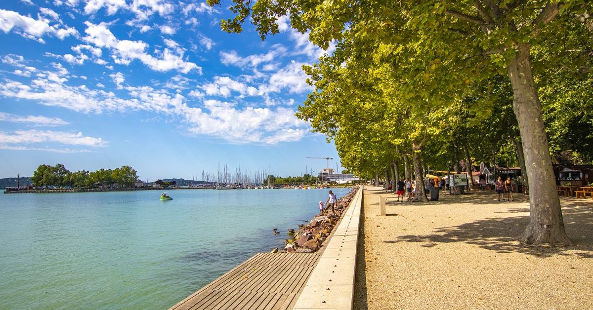
Balaton
Lake Balaton is a freshwater lake in the Transdanubian region of Hungary. It is the largest lake in Central Europe, and one of the region's foremost tourist destinations. The Zala River provides the largest inflow of water to the lake, and the canalised Sió is the only outflow.
The mountainous region of the northern shore is known both for its historic character and as a major wine region, while the flat southern shore is known for its resort towns. Balatonfüred and Hévíz developed early as resorts for the wealthy, but it was not until the late 19th century when landowners, ruined by Phylloxera attacking their grape vines, began building summer homes to rent out to the burgeoning middle classes
(Wikipedia) -
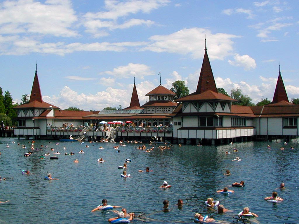
Balatonfüred
The town of Balatonfüred in the county of Veszprém, the seat of the district of Balatonfüred. The settlement originally belonged to the County of Zala from the time of King Szent István until 1946. "The capital of the northern shore of Lake Balaton", the oldest resort on the shore of Lake Balaton. It is the sixth most popular settlement in Hungary in terms of guest nights spent in commercial accommodation. In addition to its proximity to Lake Balaton, its fame is primarily due to its carbonated springs (which contain carbon bicarbonate, calcium and magnesium, which are especially beneficial for the treatment of circulatory disorders and cardiovascular diseases) and its Mediterranean climate. A major sailing port.
Its territory is made up of three parts: the ancient settlement on both sides of the railway line, the old health resort around the healing springs, and the centers, hostels, campsites, resorts, etc. that accommodate the latest holiday/tourist life of Füred on both sides. area. The former village of Balatonarács was added to it in 1954.
(Wikipedia) -

Budapest
Budapest is the capital and the most populous city of Hungary, and the tenth-largest city in the European Union by population within city limits. The city had an estimated population of 1,752,704 in 2016 distributed over a land area of about 525 square kilometres (203 square miles).
Budapest is both a city and county, and forms the centre of the Budapest metropolitan area, which has an area of 7,626 square kilometres (2,944 square miles) and a population of 3,303,786, comprising 33 percent of the population of Hungary. The history of Budapest began when an early Celtic settlement transformed into the Roman town of Aquincum, the capital of Lower Pannonia. The Hungarians arrived in the territory in the late 9th century. The area was pillaged by the Mongols in 1241. Buda, the settlements on the west bank of the river, became one of the centres of Renaissance humanist culture by the 15th century. The Battle of Mohács in 1526 was followed by nearly 150 years of Ottoman rule.
After the reconquest of Buda in 1686, the region entered a new age of prosperity. Pest-Buda became a global city with the unification of Buda, Óbuda, and Pest on 17 November 1873, with the name 'Budapest' given to the new capital. Budapest also became the co-capital of the Austro-Hungarian Empire, a great power that dissolved in 1918, following World War I. The city was the focal point of the Hungarian Revolution of 1848, the Battle of Budapest in 1945, and the Hungarian Revolution of 1956. Budapest is an Alpha − global city with strengths in commerce, finance, media, art, fashion, research, technology, education, and entertainment. It is Hungary's financial centre and the highest ranked Central and Eastern European city on Innovation Cities Top 100 index, as well ranked as the second fastest-developing urban economy in Europe. Budapest is the headquarters of the European Institute of Innovation and Technology, the European Police College and the first foreign office of the China Investment Promotion Agency.
Over 40 colleges and universities are located in Budapest, including the Eötvös Loránd University, the Semmelweis University and the Budapest University of Technology and Economics. Opened in 1896, the city's subway system, the Budapest Metro, serves 1.27 million, while the Budapest Tram Network serves 1.08 million passengers daily. Budapest is cited as one of the most beautiful cities in Europe, ranked as "the world's second best city" by Condé Nast Traveler, and "Europe's 7th most idyllic place to live" by Forbes. Among Budapest's important museums and cultural institutions is the Museum of Fine Arts. Further famous cultural institutions are the Hungarian National Museum, House of Terror, Franz Liszt Academy of Music, Hungarian State Opera House and National Széchényi Library. The central area of the city along the Danube River is classified as a UNESCO World Heritage Site and has many notable monuments, including the Hungarian Parliament, Buda Castle, Fisherman's Bastion, Gresham Palace, Széchenyi Chain Bridge, Matthias Church and the Liberty Statue. Other famous landmarks include Andrássy Avenue, St. Stephen's Basilica, Heroes' Square, the Great Market Hall, the Nyugati Railway Station built by the Eiffel Company of Paris in 1877 and the second-oldest metro line in the world, the Millennium Underground Railway. The city also has around 80 geothermal springs, the largest thermal water cave system, second largest synagogue, and third largest Parliament building in the world. Budapest attracts 4.4 million international tourists per year, making it a popular destination in Europe.
(Wikipedia) -
Bük
Bük town in Vas county, Kőszeg district. It includes Bükfürdő. It is the fourth most popular settlement in Hungary in terms of guest nights spent in commercial accommodation.
It lies 27 kilometers northeast of Szombathely, at the junction of Alpokalja and Kisalföld, on the plain of the Répce River. The Bük–Bő–Gór reservoir is located on the eastern side of the city.
(Wikipedia) -

Debrecen
Debrecen is the third largest and second most populous settlement in Hungary, the seat of Hajdú-Bihar county and the Debrecen district, a city with county rights. About 38.2% of the county's population lives here, and it is the largest city in Tiszántúl. It is sometimes referred to as "Calvinist Rome" or "Civic City". It is the spiritual, cultural, economic, tourism and transport center of the Eastern Hungary region, the Northern Great Plain statistical region and the Tiszántúl landscape, and it is one of the most dynamically developing cities in Hungary.
It is first mentioned in writing in the 13th century. In 1361, Louis I gave the citizens of Debrecen the right to elect the city's judge and council, and in addition, it was granted the status of a market town, and in 1693, a free royal city. The main source of income was the cattle trade, animal husbandry and handicrafts. Despite the booming economy, the buildings remained simple and the streets were barely paved. Multi-storey buildings were rare until the 19th century. Between 1450 and 1507 Debrecen was the seat of the noble Hunyadi family. Its name was known throughout the continent for its famous fairs and its reformed school, which was also outstanding in European terms.
(Wikipedia) -
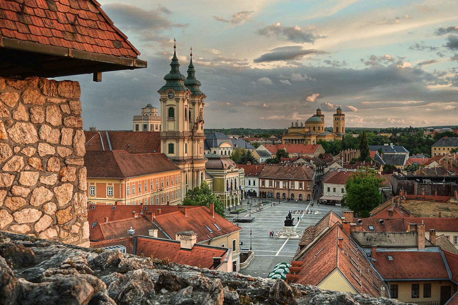
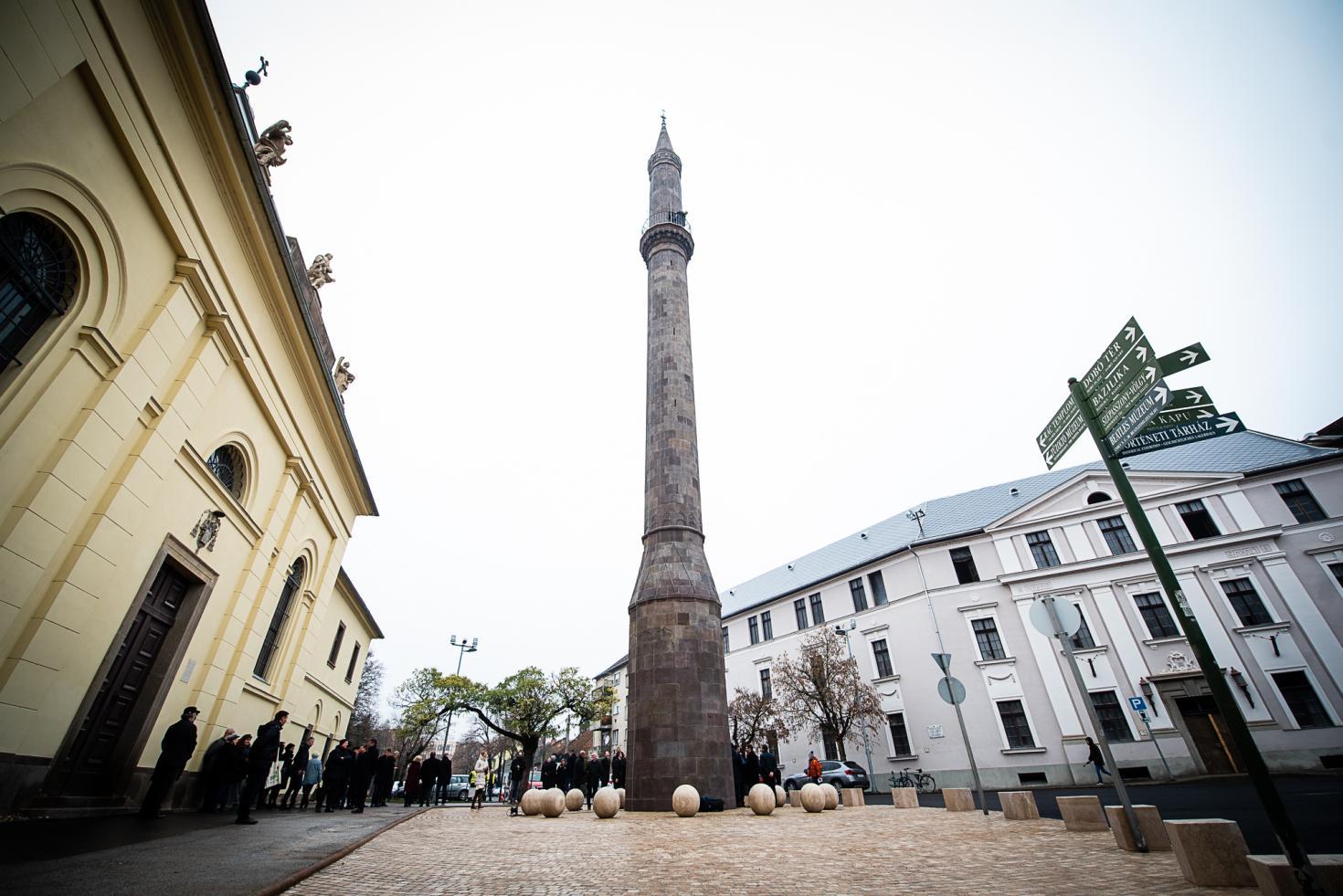
Eger
Eger is the county seat of Heves, and the second largest city in Northern Hungary (after Miskolc). Eger is best known for its castle, thermal baths, baroque buildings, the northernmost Ottoman minaret, dishes and red wines. Its population according to the census of 2011 makes it the 19th largest centre of population in Hungary. The town is located on the Eger Stream, on the hills of the Bükk Mountains. The origin of its name is still unknown. One suggestion is that the place was named after the alder ("égerfa" in Hungarian) which grew so abundantly along the banks of the Eger Stream. This explanation seems to be correct because the name of the town reflects its ancient natural environment, and also one of its most typical plants, the alder, large areas of which could be found everywhere on the marshy banks of the Stream although they have since disappeared.
The German name of the town: Erlau=Erlen-au (elder grove) also speaks in favour of this supposition. And there is another theory which says that Eger's name comes from the Latin word: "ager" (earth). This theory comes from more recent researchers[who?] who think that during the 11th and 12th centuries settlers with a Walloon origin ("latins" in Hungarian) moved to this territory. The basin of Eger and the hilly region around it have always been very suitable for human settlements, and there are many archaeological findings from the early ages of history, which support this fact. The other names of the town are in Latin as Agria, in Serbian and Croatian as Jegar / Јегар or Jegra / Јегра, in Czech and Slovene language as Jager, in Slovak language as Jáger, in Polish as Jagier, and in Turkish as Eğri.
(Wikipedia) -
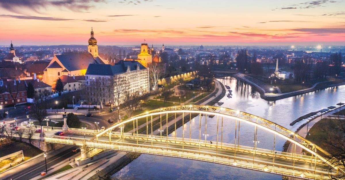
Győr
Győr is a city with county rights in Hungary, the center of the Western Transdanubia region, the seat of Győr-Moson-Sopron county and Győr district, and since 1009 the center of Győr diocese. An important economic, cultural, university and sports center, it is one of the most dynamically developing cities in the country. It lies on the innovative Vienna-Pozsony-Budapest axis and has excellent transport facilities. As the third-richest city in Hungary in terms of monuments, it won the Europa Nostra prize for monument protection in 1989 in recognition of the reconstruction of the baroque downtown. Győr is also the "city of rivers", because it was built in the eastern half of the Little Plain, next to the Mosoni-Danube, at the mouth of the Rába and Rábca rivers. It was precisely this riverside location that greatly facilitated the formation and development of the settlement.
In ancient times, the Roman settlement of Arrabona was located in the area of today's Győr. This is where the town's German name "Raab" comes from. After the Hungarian conquest, the Hungarian king István I established the diocese of Győr in 1001, which became its center in 1009, when the cathedral was completed. During the Turkish wars, Győr was one of the last bastions of Vienna, and therefore had inestimable military importance.
(Wikipedia) -

Gyula
It is located in the southeastern part of the Great Plain, on the Körös plain, on the left bank of Fehér-Körös, right next to the Romanian border. It is located in one of the deepest areas of Hungary, at an altitude of 88 meters above sea level, in a flat area. The climate of the region is moderate and continental.
The nearest neighboring town is Békéscsaba, which is 16 kilometers west of it.
Fehér- and Fekete-Körös are among the cleanest rivers in Hungary; the riverbanks and forests located here - which have now been classified as protected areas - are particularly beautiful in terms of landscape. The city itself has a significant tourist role with its many parks, monuments, and cozy streets, and last but not least, its character as a spa town.
(Wikipedia) -
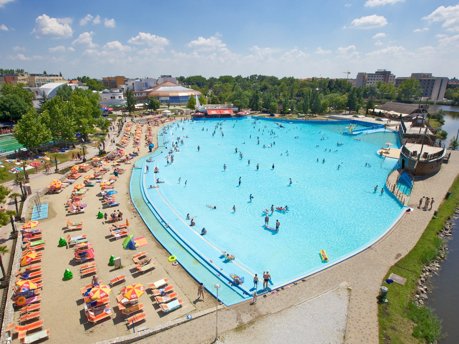
Hajdúszoboszló
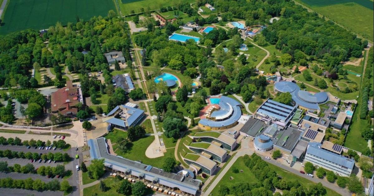
Hajdúszoboszló, the most well known bathing city of the Hungarian Great Plain welcomes you and your family. Be our guests in order to be able to experience the full adventure of recreation! The conditions of active and passive recreation are available in Hajdúszoboszló thanks to the endowments and services of the city. The catering units, hotels and the city of Hajdúszoboszló offer a wide variety of programs in addition to bathing. The well maintained and landscaped resort city is perfectly suitable for the recreation of families and those, who wish to recuperate, who wish to refresh themselves.
The Bath Complex represents the main attractive power of Hajdúszoboszló, which consists of the famous spa, the Aquapark, the open-air bath and the Aqua Palace Adventure Bath that was opened in year 2010. The Bath Complex with its services offers an unforgettable adventure throughout the year for the recuperating and recreating guests and for small and large families.
(Wikipedia) -
Hévíz
Hévíz town in Zala county, Keszthely district. Its main attraction is the natural pond-filled hot water lake in Europe, which makes it one of Hungary's top tourist destinations. The history of the bathing site dates back to pre-historic times. The healing effect of Lake Hévíz was probably already known by the Romans, as evidenced by the coins collected by the divers in the early 1980s and the altar found around the lake. The findings of the migration migration also suggest that the Germanic and Slavic people who turned to it used the lake as well. Hévíz is mentioned for the first time in a diploma from 1328 when the settlement is referred to as locus vulgarites Hewyz dictus.
The first study about the lake was published in 1769 by Ferenc Szláby. The Festetics played an important role in the creation / development of the spa, and the source and its surroundings were in the middle of the 18th century. The flowering of the bathing life is mainly due to Count Festetics, who purposefully built the bathing area. Today's settlement was formed by the unification of the villages of Hévízszentandrás and Egregy in 1946. On May 1, 1992, he received an urban title.
(Wikipedia) -
Miskolc
Miskolc is a county town in the northeastern part of Hungary, on the eastern slopes of the Bükk region. It is the center and largest settlement of the Northern Hungary region. Borsod-Abaúj-Zemplén county and seat of the Miskolc district. A quarter of the county's population lives in Miskolc. It is the fourth most populous city in the country after Budapest, Debrecen and Szeged, together with the agglomeration it is the third largest after Budapest and Debrecen, and the second largest city in Hungary with a built-up area after Budapest.
The area is one of the oldest inhabited areas in Europe, as evidenced by Paleolithic finds. The settlement, built at the junction of various geographical units, along important trade routes, was already a trading town in the Middle Ages, and in 1365 it received city status from King Louis the Great. After the Turkish subjugation, its industry also began to develop.
(Wikipedia) -

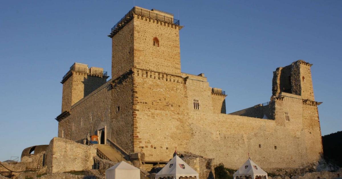
Sárvár
Sárvár is a city in Western Transdanubia, the second largest city in Vas county, and the seat of the Sárvár district. The 7th most popular settlement in Hungary in terms of guest nights spent in commercial accommodation. Sárvár is located on the banks of the Rába, near Kemeneshát. The castle is the namesake of the settlement. Originally, it could have been an earth castle surrounded by marshes.
(Wikipedia) -

Siófok
Siófok is a port and resort town in the northeastern part of Somogy county. It is the seat of the Siófok district, the most populous and largest settlement on the Balaton coast, and the second most populous settlement in Somogy County.
About the famous emblematic buildings, great beaches and nightlife of the settlement. Thanks to its 17-kilometer coast, hotels, and numerous bars, restaurants, and nightclubs, the city is the second most popular domestic destination in Hungary (right after Budapest). Thanks to its tourism, it is one of the richest settlements in Hungary.
(Wikipedia) -

Sopron
Sopron is a city with more than sixty thousand inhabitants in the county of Győr-Moson-Sopron, the center of the Sopron wine region, the seat of the Sopron district. "The Most Faithful City" (Latin: Civitas Fidelissima). It is one of the oldest cities in Hungary, and because of its proximity to the border, it creates a connection between our country and our western neighbor, Austria. It is the second richest settlement in Hungary in terms of monuments.
(Wikipedia) -

Szeged
Szeged is a city with county rights, the third most populous settlement in Hungary, the largest settlement in the Southern Great Plain, the seat of the Csongrád-Csanád county and the Szeged district at the confluence of the Tisza and Maros rivers.
The area has been inhabited since the Neolithic Age, the first archaeological finds date back to the Neolithic, i. e. Around the 6th millennium. Szeged was founded by the Romans under the name Partiscum, and salt, gold and wood were also transported on the waterways and land routes that pass through Szeged even today. The excavations indicate that the Hun king Attila had a base here, and after the Hungarian conquest, the Hungarians settled here in the 10th century. The flood of 1879 is one of the most decisive events in the history of Szeged and the development of today's cityscape. Most of the buildings were destroyed, and today's Szeged was largely built after the flood: nicer, more modern buildings replaced the old ones. Only 300 of the approximately 6,000 houses survived the flood.
(Wikipedia) -

Zalakaros
Zalakaros resort town in the district of Nagykanizsa, Zala county, in the Zalaapáti-hát area. It is located in the southeastern part of the county, between Keszthely and Nagykanizsa, and owes its tourism to the thermal baths operating in the settlement. Member of the Association of Hungarian Spa Cities. In terms of guest nights spent in commercial accommodation, it is the 7th most popular settlement in Hungary, and at the same time the 6th city with the smallest population.
(Wikipedia)
Malta
-
Malta Island
Malta is a Southern European island country consisting of an archipelago in the Mediterranean Sea. It lies 80 km (50 mi) south of Italy, 284 km (176 mi) east of Tunisia, and 333 km (207 mi) north of Libya.
With a population of about 475,000[4] over an area of 316 km2 (122 sq mi),
Malta is the world's tenth smallest and fifth most densely populated country. Its capital is Valletta, which is the smallest national capital in the European Union by area at 0.8 km.2 The official languages are Maltese and English, with Maltese officially recognised as the national language and the only Semitic language in the European Union. Malta has been inhabited since approximately 5900 BC. Its location in the centre of the Mediterranean has historically given it great strategic importance as a naval base, with a succession of powers having contested and ruled the islands, including the Phoenicians and Carthaginians, Romans, Greeks, Arabs, Normans, Aragonese, Knights of St. John, French, and British.
Most of these foreign influences have left some sort of mark on the country's ancient culture. Malta became a British colony in 1815, serving as a way station for ships and the headquarters for the British Mediterranean Fleet. It played an important role in the Allied war effort during the Second World War, and was subsequently awarded the George Cross for its bravery in the face of an Axis siege, and the George Cross appears on Malta's national flag.
The British Parliament passed the Malta Independence Act in 1964, giving Malta independence from the United Kingdom as the State of Malta, with Queen Elizabeth II as its head of state and queen. The country became a republic in 1974. It has been a member state of the Commonwealth of Nations and the United Nations since independence, and joined the European Union in 2004; it became part of the eurozone monetary union in 2008.
(Wikipedia) -
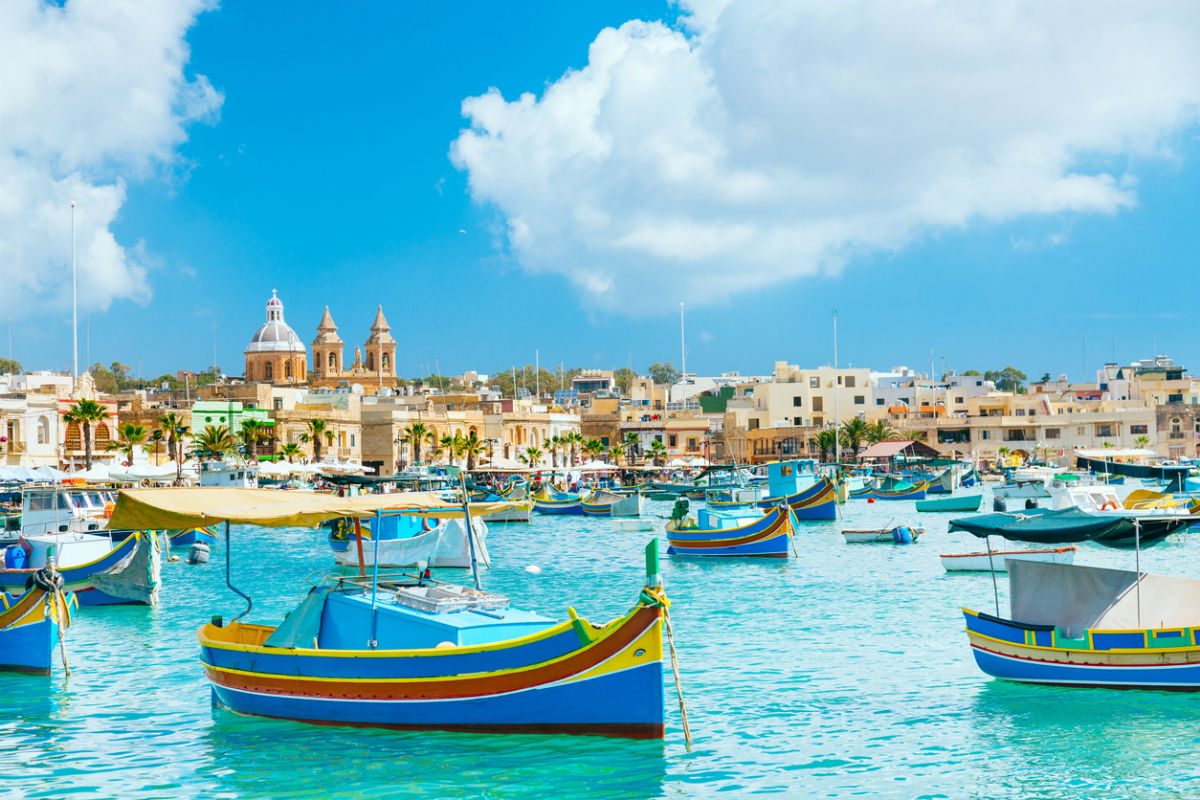
Marsaxlokk
Marsaxlokk is a small, traditional fishing village in the South Eastern Region of Malta. It has a harbour, and is a tourist attraction notable for its picturesque views, its fishermen and history. As at March 2014, the village had a population of 3,534. The village is also known for the Marsaxlokk Market, which is mainly a large fish market which takes place along the seafront on Sundays, and a tourist market during all other days of the week. Inhabited and well-known since antiquity, Marsaxlokk was used as a port by Phoenicians, Carthaginians and also has the remains of a Roman-era harbour.
Originally a part of the city of Żejtun, the fishing village became a separate parish in the late nineteenth century. Traditional luzzi and other larger and more modern vessels line the sheltered inner harbour. The village is also popular among locals and tourists alike for its peaceful walks around the coast and harbour, its many restaurants, as well as for its secluded and untainted swimming zones. Marsaxlokk Bay also includes a container freeport towards Birżebbuġa, a power station complex towards Delimara, and a small ship-repair facility for fishermen. Marsaxlokk is sometimes referred to as Portus Herculis, due to the association of Marsaxlokk Bay with the Roman and Punic remains at Tas-Silġ.
(Wikipedia) -
Mdina
Mdina is a fortified city in the Northern Region of Malta, which served as the island's capital from antiquity to the medieval period. The city is still confined within its walls, and has a population of just under 300, but it is contiguous with the town of Rabat, which takes its name from the Arabic word for suburb, and has a population of over 11,000 (as of March 2014). The city was founded as Maleth in around the 8th century BC by Phoenician settlers, and was later renamed Melite by the Romans.
Ancient Melite was larger than present-day Mdina, and it was reduced to its present size during the Byzantine or Arab occupation of Malta. During the latter period, the city adopted its present name, which derives from the Arabic word medina. The city remained the capital of Malta throughout the Middle Ages, until the arrival of the Order of St. John in 1530, when Birgu became the administrative centre of the island. Mdina experienced a period of decline over the following centuries, although it saw a revival in the early 18th century.
At this point, it acquired several Baroque features, although it did not lose its medieval character. Mdina remained the centre of the Maltese nobility and religious authorities (and property continues to largely be passed down from families and from generation to generation), but it never regained its pre-1530 importance, giving rise to the popular nickname the "Silent City" by both locals and visitors. Mdina is on the tentative list of UNESCO World Heritage Sites, and it is now one of the main tourist attractions in Malta. -
Sliema
Sliema is a town located on the northeast coast of Malta in the Northern Harbour District. It is a major residential and commercial area and a centre for shopping, dining, and café life. Lining the coastline is a promenade known as the Sliema Front, that has become the ideal spot for joggers and walkers as well as a prolific meeting place for locals during the summer season. Romantic moon strolls, barbeques and open air restaurants Tattoo and Piercing and cafes have made Sliema the hub of social nightlife. Sliema is also known for its numerous rocky beaches, water sports and hotels. Sliema, which means 'peace, comfort', was once a quiet fishing village on the peninsula across Marsamxett Harbour from Valletta and has views of the capital city.
The population began to grow in 1853 and the town was declared a parish in 1878. Now Sliema and the coastline up to neighbouring St. Julian's constitutes Malta's main coastal resort. Sliema is considered a desirable place to live and is relatively affluent, with extremely high property prices compared to the national average. Historically, stylish villas and traditional Maltese townhouses lined the streets of Sliema. Sliema has now been ringed with modern apartment blocks, some of which are amongst the tallest buildings in Malta. This has resulted in significant traffic, parking and construction-related noise pollution issues.
(Wikipedia) -

St. Julian's
Saint Julian's (Maltese: San Ġiljan) is a town in the Central Region of Malta. It is situated along the coast, north of the country's capital, Valletta. It is known for tourism-oriented businesses, such as hotels, restaurants and nightclubs which are centred mainly in an area known as Paceville. The town is named after its patron saint; Saint Julian who is widely known as Julian the Hospitaller and Julian the Poor whereby he is the patron Saint of hunters. Before the reform to the Calendar of Saints, the memorial to St Julian was on 27 January. Nowadays, it is celebrated on 12 February, although in Malta an additional feast, in the spirit of the many summer feasts around the island, is celebrated on the last Sunday of August.
(Wikipedia) -
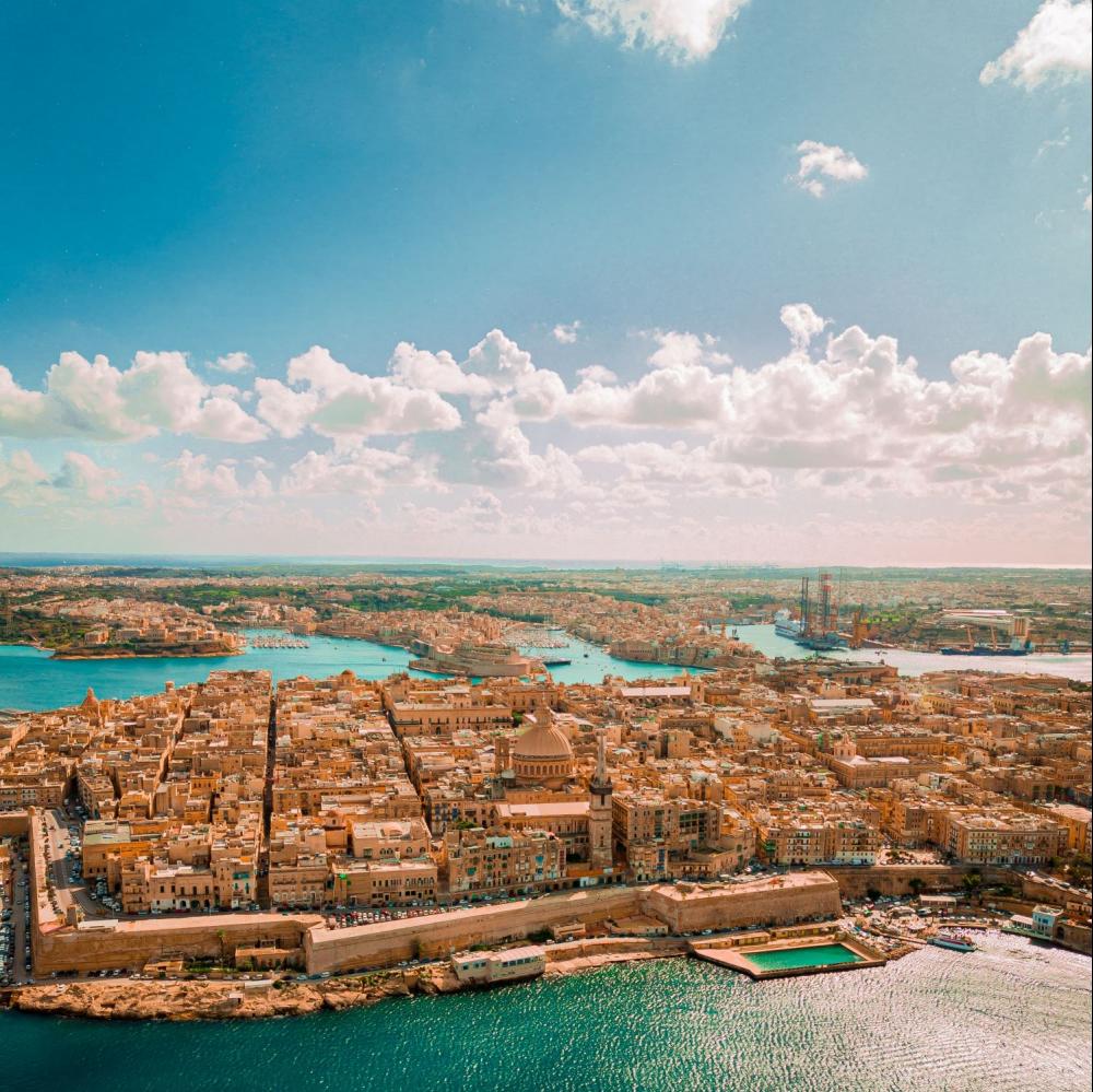
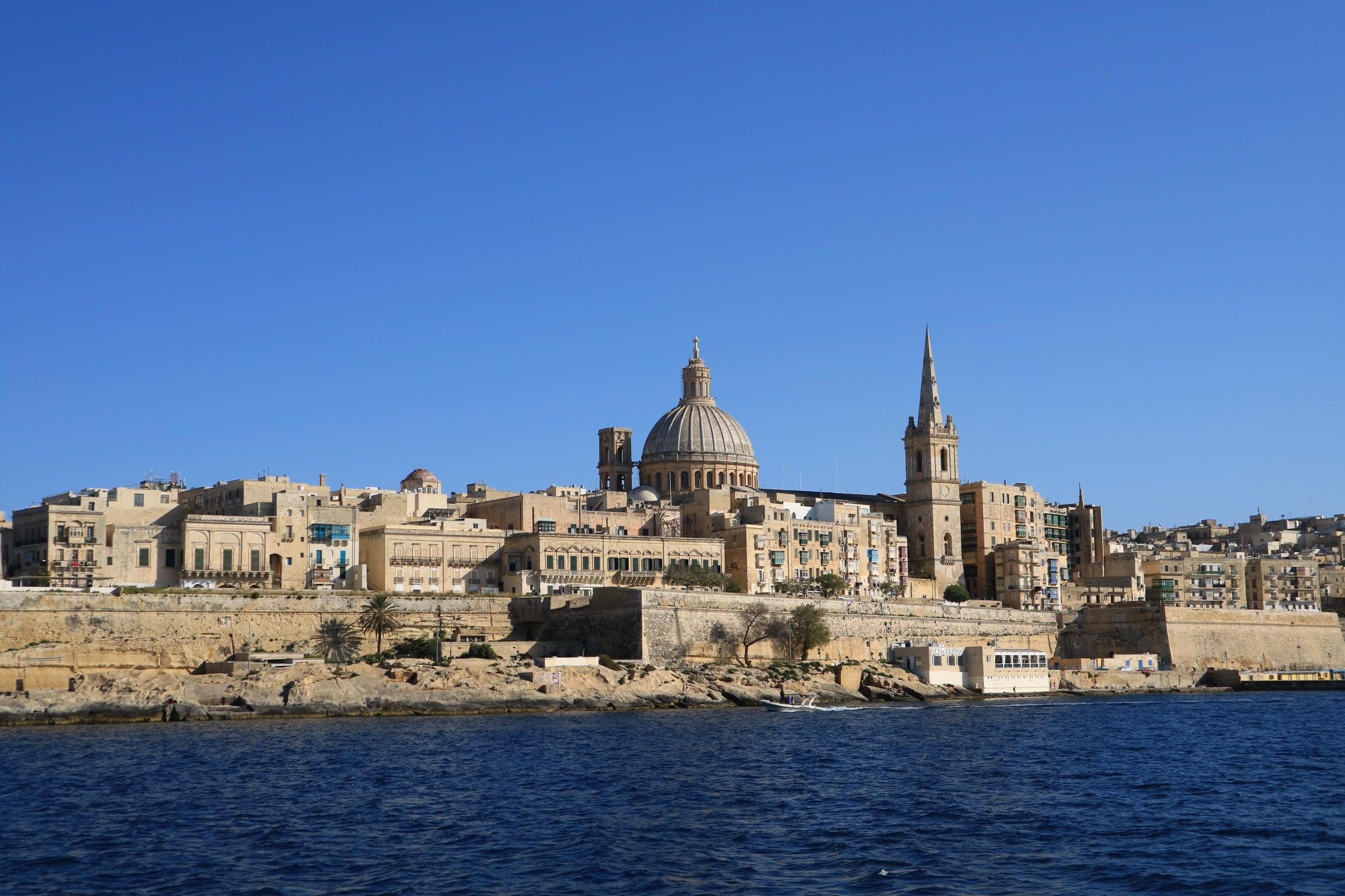
Valletta
Valletta is the capital city of Malta. Located in the south east of the island, between Marsamxett Harbour to the west and the Grand Harbour to the east, its population in 2014 was 6,444, while the metropolitan area around it has a population of 393,938. Valletta is the southernmost capital of Europe. Valletta's 16th century buildings were constructed by the Knights Hospitaller.
The city is Baroque in character, with elements of Mannerist, Neo-Classical and Modern architecture, though the Second World War left major scars on the city, particularly the destruction of the Royal Opera House.
The city was officially recognised as a World Heritage Site by UNESCO in 1980. The city's fortifications, consisting of bastions, curtains and cavaliers, along with the beauty of its Baroque palaces, gardens and churches, led the ruling houses of Europe to give the city its nickname Superbissima— Italian for Most Proud.
(Wikipedia) -

Birgu
Birgu (Maltese: Il-Birgu, Italian: Vittoriosa), also known by its title Città Vittoriosa ("Victorious City"), is an old fortified city on the south side of the Grand Harbour in the South Eastern Region of Malta. The city occupies a promontory of land with Fort Saint Angelo at its head and the city of Cospicua at its base. Birgu is ideally situated for safe anchorage, and over time it has developed a very long history with maritime, mercantile and military activities.
Birgu is a very old locality with its origins reaching back to medieval times. Prior to the establishment of Valletta as capital and main city of Malta, military powers that wanted to rule the Maltese islands would need to obtain control of Birgu due to its significant position in the Grand Harbour. In fact, it served as the base of the Order of Saint John and de facto capital city of Malta from 1530 to 1571. Birgu is well known for its vital role in the Great Siege of Malta of 1565.
In the early 20th century, Birgu had a population of over 6000 people. Over the years this decreased, and the population stood at 2,629 in March 2014.
(Wikipedia)
-

Gozo Island
Gozo, known locally as Għawdex is an island of the Maltese archipelago in the Mediterranean Sea. The island is part of Malta. After the island of Malta itself, it is the second-largest island in the archipelago. Compared to its southeastern neighbour, Gozo is more rural and known for its scenic hills, which are featured on its coat of arms. The island of Gozo has long been associated with Ogygia, the island home of the nymph Calypso in Homer's Odyssey. In that story, Calypso, possessed of great supernatural powers, and in love with Odysseus, holds him captive for a number of years, until finally releasing him to continue his journey home. As of March 2015, the island has a population of around 37,342 (out of Malta's total 475,000), and its inhabitants are known as Gozitans (Maltese: Għawdxin). It is rich in historic locations such as the Ġgantija temples, which, along with the other Megalithic Temples of Malta, are among the world's oldest free-standing structures. The island is rural in character and, compared to the main island Malta, less developed.
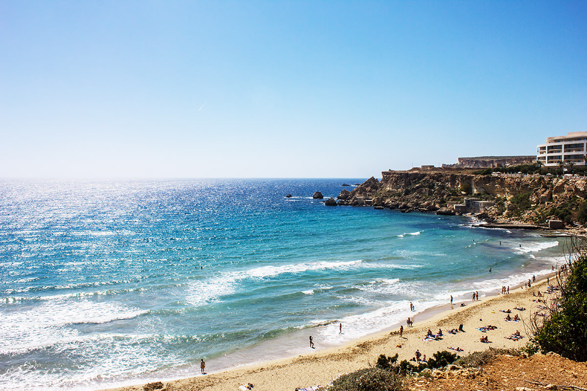
It was known for the Azure Window, a natural limestone arch that was a remarkable geological feature, until its collapse in 2017. The island has other notable natural features, including the Inland Sea and Wied il-Mielaħ Window. There are many beaches on the island, as well as seaside resorts that are popular with both locals and tourists, the most popular being Marsalforn and Xlendi. Gozo is considered one of the top diving destinations in the Mediterranean and a centre for water sports. -

Xlendi Bay
Xlendi Malta Bay Gozo is located at the bottom of a very steep valley starting from the village of Kercem which is located very close to Victoria (Rabat), the capital city.
During the descent down to the Bay one can appreciate the greenery all around and the deeper one descends into the valley, one may also notice the abundance of cane growing in the valley, depending on the time of the year arriving at the car park soon after.
-
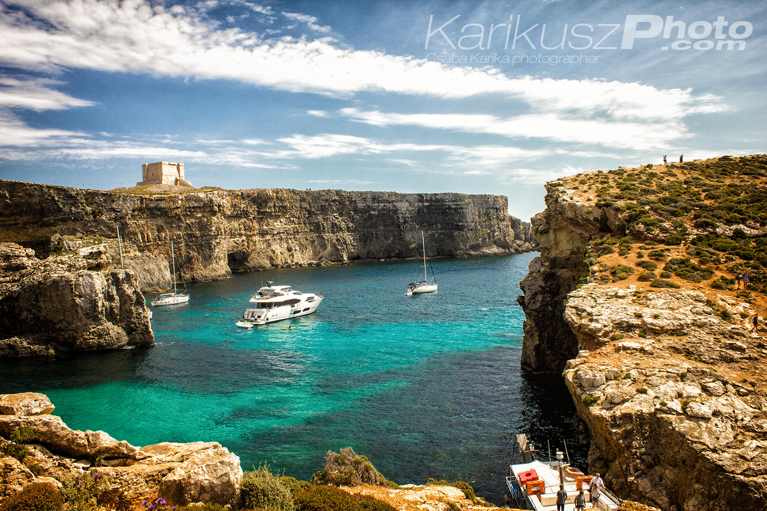
Comino
Comino (Maltese: Kemmuna), formerly called Ephaestia (Ηφαιστεία in Ancient Greek) is a small island of the Maltese archipelago between the islands of Malta and Gozo in the Mediterranean Sea, measuring 3.5 square kilometres (1.4 sq mi) in area.
Named after the cumin seed that once flourished in the Maltese islands, the island is the least densely populated area in the Republic of Malta. It has a permanent population of only three residents, following the death of the fourth resident in 2017. Administratively, it is part of the municipality of Għajnsielem, in southeastern Gozo.
One priest and one policeman commute from the nearby island of Gozo. The island is a bird sanctuary and nature reserve.
(Wikipedia)